
 Yahoo Finance
NASA satellites are tracking Katia, Irma and Jose and the images are staggering
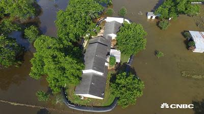
NASA is leveraging its fleet of domestic and international satellites orbiting in space to help track the current lineup of hurricanes gathering steam and heading towards the United States. The satellites are tracking rainfall, wind speeds, temperatures (as in the image embedded above) and position. The images are staggering both because of the technology required to obtain them and the size and scope of the storms they depict. The government's preeminent space department leverages its terabytes of data coming from orbiting satellites to help inform and protect people and infrastructure in times of disaster in a program called the NASA Earth Science Disasters Program. It was started 10 years ago informally and about a year and a half ago became more coordinated, according to a statement from NASA. Space data from NASA was used in 2010 to help coordinate response to the Deepwater Horizon spill in the Gulf of Mexico, and in 2015, NASA generated maps showing the wreckage of the Gorkha earthquake in Nepal. Currently, NASA is tracking Hurricanes Irma and Jose. Hurricane Irma has barreled through the Caribbean and is now heading towards Florida . Hurricane Jose is developing further out in the Atlantic behind Irma, while Katia, which developed in the Gulf of Mexico as a hurricane, was downgraded to a tropical depression.Watch the three weather systems in the NASA video embedded below. The image embedded below shows the temperature of the ocean by location. Warm ocean temperatures feed a hurricane, according to NASA. This image shows a rainfall analysis for Hurricane Irma. The short video below circles around a 3-D animation of the rainfall of Hurricane Irma. The video below shows both hurricanes Irma and Jose as seen from the International Space Station. And below you can see lightning flashing in the three-day time lapse video. See also: Billionaire entrepreneur Richard Branson survived Hurricane Irma holed up in his concrete wine cellar Hurricane Irma on track to hit world's busiest airport FEMA ready to handle an onslaught of hurricanes, official says Like this story? Like CNBC Make It on Facebook.
More From CNBC
